The Sky’s New Eyes: LiDAR Drone Mapping Reveals Hidden Worlds
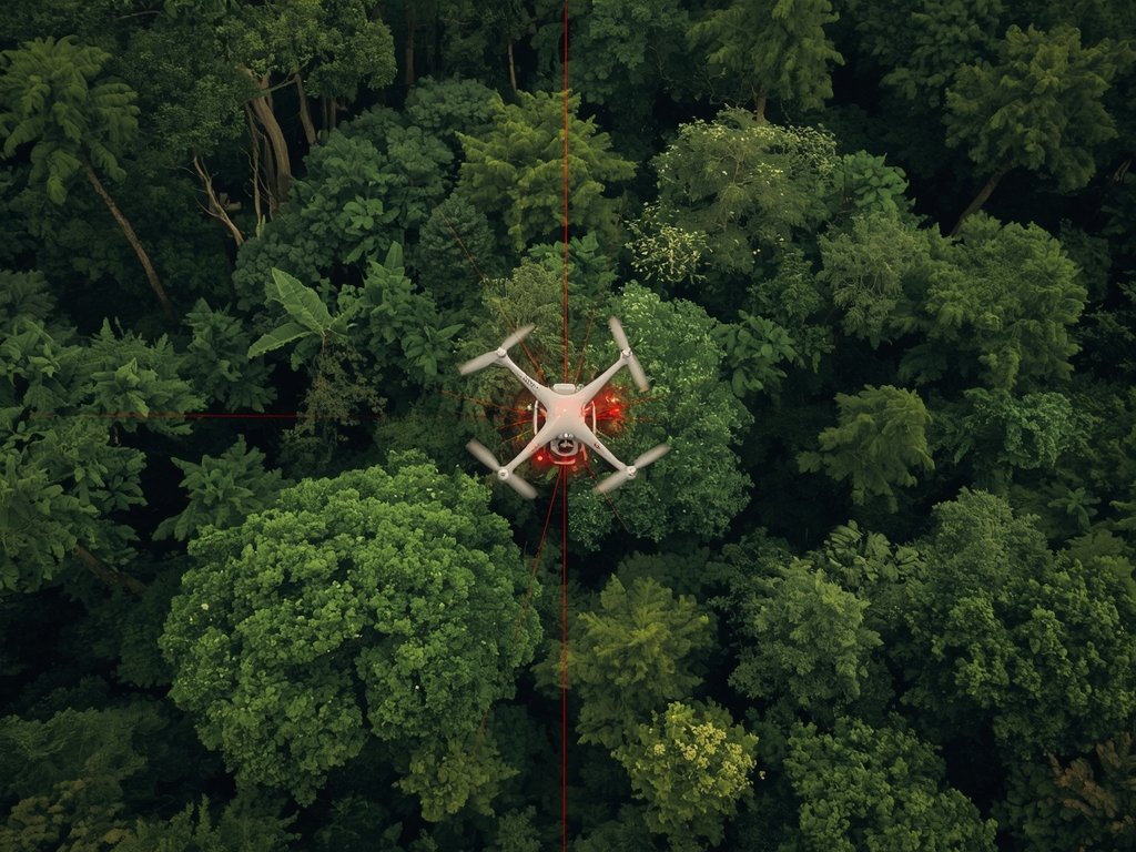
Imagine peering through centuries of overgrown jungle, not with a machete, but with a laser. That’s the power of LiDAR drone mapping, a revolutionary technology transforming archaeology. Across the globe, from the misty mountains of Central America to the arid deserts of the Southwest, these flying archaeologists are uncovering lost cities, forgotten civilizations, and secrets buried beneath the earth.
In the United States, LiDAR is rewriting history. In 2016, a team using this technology discovered a sprawling network of ancient settlements hidden beneath the dense forests of Mississippi. These findings challenged long-held beliefs about the complexity and scale of Native American societies in the region.
From Mayan Pyramids to Lost Pueblos: LiDAR’s Global Impact
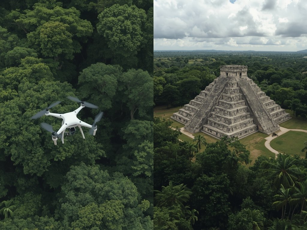
The impact of LiDAR isn’t limited to the US. In Guatemala, archaeologists used LiDAR to map the ancient Maya city of Tikal, revealing a metropolis far larger and more interconnected than previously thought. Hidden temples, palaces, and even entire neighborhoods emerged from the digital fog, painting a new picture of this once-powerful civilization.
Closer to home, in New Mexico’s Chaco Canyon, LiDAR has shed light on the intricate network of roads connecting the ancient Puebloan great houses. These findings suggest a level of social organization and engineering prowess previously unrecognized.
How LiDAR Works: Peeling Back the Layers of Time
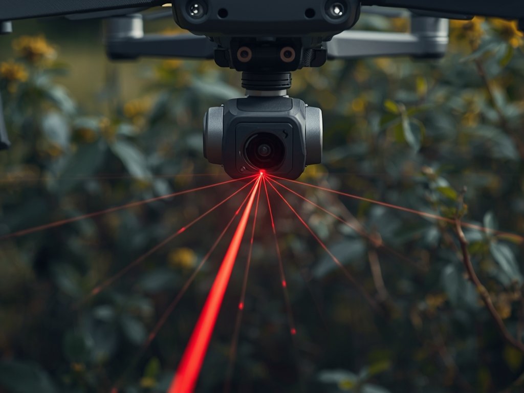
So, how does this magical technology work? LiDAR, which stands for Light Detection and Ranging, uses laser pulses to measure distances with incredible precision. Mounted on drones, these sensors fire thousands of laser beams per second, penetrating dense vegetation and creating a detailed 3D map of the ground below.
Think of it like an X-ray for the earth. By analyzing the reflected laser light, archaeologists can distinguish between natural features and man-made structures, even those hidden beneath centuries of growth.
Unveiling the Invisible: LiDAR’s Advantages Over Traditional Methods
Traditional archaeological methods, while invaluable, are time-consuming and often limited by terrain and vegetation. LiDAR offers several key advantages:
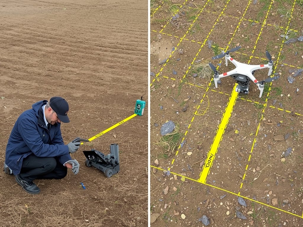
- Speed and Efficiency: LiDAR can map vast areas in a fraction of the time it would take a team of archaeologists on the ground.
- Precision: The technology provides incredibly detailed data, allowing for the identification of subtle features that might be missed by the human eye.
- Non-Invasiveness: LiDAR is a non-destructive method, leaving archaeological sites untouched while revealing their secrets.
The Future of Discovery: LiDAR and the Next Chapter of Archaeology

As LiDAR technology continues to evolve, its potential for archaeological discovery is limitless. From uncovering lost cities in the Amazon to mapping ancient trade routes across continents, this technology is rewriting our understanding of the past.
In the United States, LiDAR is being used to identify potential archaeological sites on federal lands, guiding future excavations and preservation efforts. It’s also being employed to monitor the impact of climate change on ancient structures, helping us protect these invaluable cultural treasures for future generations.
FAQ
What is LiDAR drone mapping?
LiDAR drone mapping uses laser technology mounted on drones to create detailed 3D maps of the ground, even through dense vegetation.
How is LiDAR changing archaeology?
LiDAR is revolutionizing archaeology by allowing researchers to discover hidden structures, map large areas quickly, and gain new insights into ancient civilizations.
Where has LiDAR been used to uncover ancient civilizations?
LiDAR has been used globally, from Mayan cities in Guatemala to Puebloan settlements in New Mexico, revealing previously unknown structures and settlements.
What are the advantages of LiDAR over traditional archaeological methods?
LiDAR is faster, more precise, and non-invasive compared to traditional methods, allowing for large-scale mapping and the detection of subtle features.
What does the future hold for LiDAR in archaeology?
LiDAR’s potential is vast, promising to uncover more lost cities, map ancient landscapes, and guide preservation efforts for cultural heritage sites.
Join Our Pilot Community
Connect with fellow drone enthusiasts, share your aerial shots, and get access to free PDF ebook guides.